Myanmar has a rich and diverse coastline, a fertile coastal plain, productive offshore waters and a tropical climate which provides a strong basis for integrated sustainable development that will support both society and healthy ecosystems and biodiversity.
One third of Myanmar’s total parameter of 1930 Kilometers forms an uninterrupted coastline along the Bay of Bengal and the Andaman Sea. Myanmar’s coastline can be divided into 3 major coastal regions and portions of the 3 division; Yangon, Bago and Mon also fall under the coastal regions.
- The Rakhine coastline is about 740 Kms long and extends from the Naff River to Mawtin Point. It is shallow and deltaic in the northern section and rocky in the southern part.
- The Deltaic coastal region extends about 460 Kms from Mawtin Point to the Gulf of Mottama (Martaban) and consists of the entire river-mouth areas of three major rivers, the Ayeyarwaddy, Sittaung and Thanlwin. The southeastern portion of the central deltaic area comprises the coast of Mon State and the Thanlwin River opens into the Gulf of Mottama and Balu-Kyune (Giant Island) lies at its mouth.
- The 900 Kms long Tanintharyi coastline extends from the Gulf of Mottama south to the mouth of the Pakchan River. It is fringed in the southern part by the Myeik (Mergui) Archipelago Island chain.
There are many estuaries and islands along these coastal regions. There are valuable natural resources in those regions such as mangroves, coral reefs, sea-grass beds, sandy beaches, intertidal mudflats, mountains, terrestrial and wetland forests, fishery, and various minerals.
Unsustainable development in Myanmar has been damaging the coastal ecosystems (particularly mangroves forests and overfishing), which exacerbate rural poverty in coastal areas. Exploitation of coastal resources has increased to such an alarming rate that is now time for their improved management and sustainable utilization of coastal resources.
Coastal resources management includes a wide array of management practices such as land use planning, institutional execution, inspection and control of adherence to decisions, wood and non-wood forest products, fishery resources, hunting, peat and the rights of different interest groups and so on.
Similarly, its management is too complex to be handled by a sectorial planning and management. To be effective, planning for integrated coastal area management (ICAM) must be coordinated between sectoral implementing agencies.
Therefore, to solve this situation in Myanmar, Union level Coastal Natural Resource Management Central Committee includes different Ministries and Departments and is led by Vice President and was formed on 30th November 2016 by the Republic of the Union of Myanmar. After which, similar committees in State & Regional of coastal region in Yangon, Rakhine, Tanintharyi, Ayerwaddy, Mon and Bago were designated respectively.
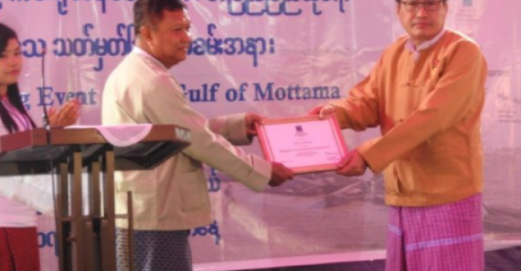
Gulf of Mottama Project (GoMP) has been implementing with the 3 major objectives (Livelihood, Natural resources conservation and Governance) especially at 37 villages of 5 townships in Mon State and 23 villages of 3 townships in Bago Region.
One of the major priority of GoMP among other activities which is to support and facilitate the “Sittaung River Mouth Natural Resource Management Committee in Bago Region and “Coastal Resource Management Committee” in Mon State.
The aim for those committees is to implement the sustainable Gulf of Mottama Management Plan to benefit communities and their livelihood. This is not an easy task because there are many requirements and issues in these two committees which were identified throughout the project working with them.
These issues are entirely based on how committees were formed because there are various departments and Ministries like in National level. In each committee, Chief Minister is the Chairperson and Forest, Fishery and Environmental Conservation Departments are as Secretary and joint Secretary respectively.
The GoMP has been gradually trying to get their collaboration and cooperation since early 2019. That is why, in 2020, The coordination channels between the two CRMCs and GoMP are improved but still they are facing many challenges. They still need further support and strengthening measures.
The project’s target for both committees in 2020, is to establish separate focal offices to form township working groups, to build capacity related with natural resource conservation and finally to sign a Memorandum of Understanding (MoU) between the two CRMCs of both governments and GoMP.
The GoMP is assisting the two CRMCs to complete the targets as outlined in the annual work plan cost estimate for 2020. The 2CRMC to finish mentioned targets. If the mentioned targets are completed in 2020, the committees will be well on the way to complete other coastal resources activities in accordance with their ToRs in coming years after developing an action plan for the period 2022-2024. On the other hand, community participation is of the utmost importance in the successful management and protection of coastal resources.
Natural resource conservation is impossible to be done by only government departments and it should involve active participation and full support of the communities and other stakeholders’ sectors in planning and observing appropriate use of coastal resources. As a result, The CRMCs agreed to include representation from Fisheries Development Associations (FDA) and Coastal Farmers Development Associations (CFDA), village authorities and private sector into these townships working group.
Although our objectives are geared towards integrated coastal management, including the coastal areas and its surrounding environment. Moreover, the physical environment is not the only consideration in natural resource conservation; but also includes cultural, political and socio-economic factors which effect coastal residents.
After all these aspects are included the two CRMCs can become truly inclusive governing bodies which will function well beyond 2020.